General Knowledge
India’s Neighbouring Countries

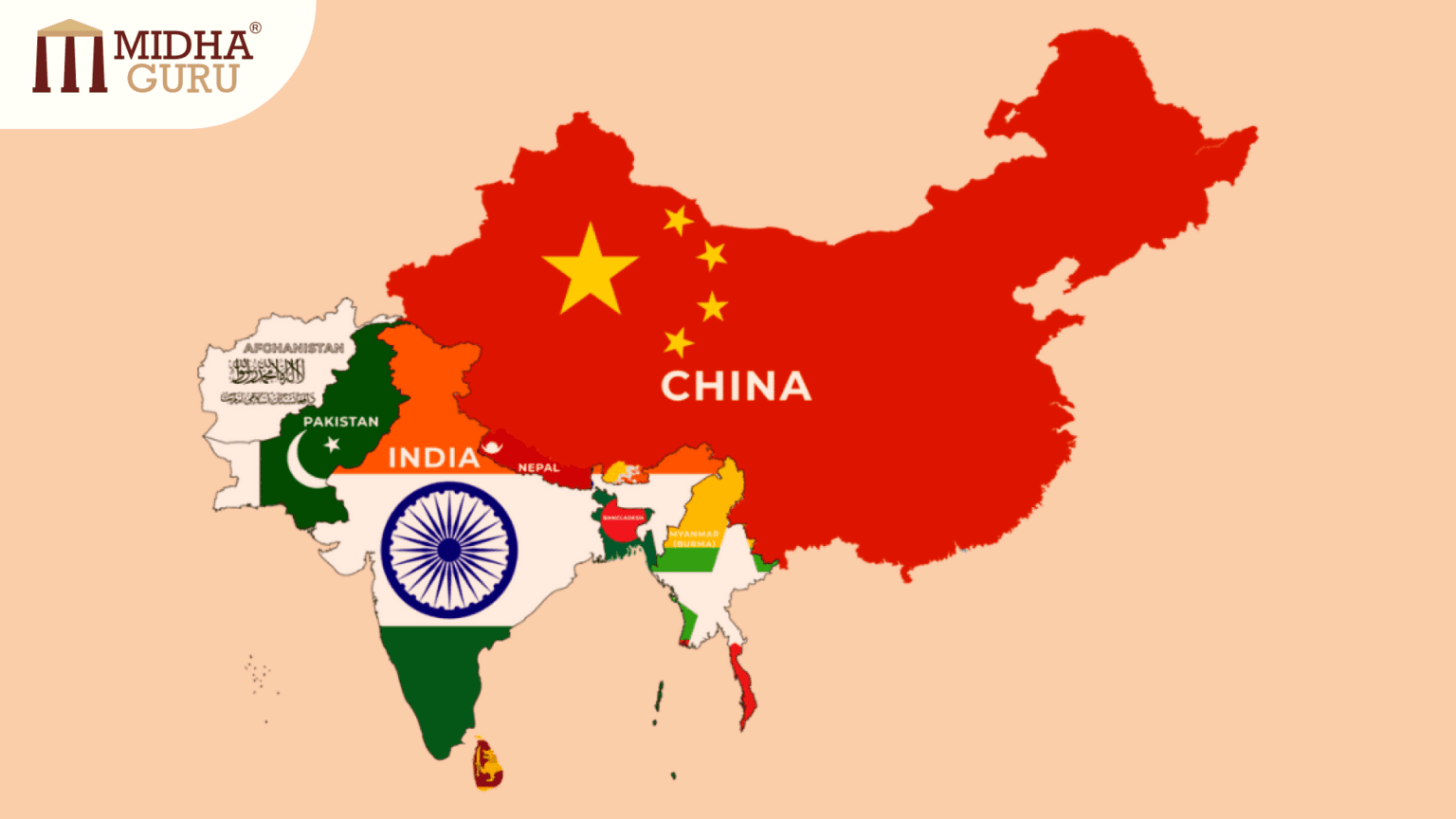
India, the seventh-largest country in the world, is strategically located in South Asia. Its vast landmass shares borders with several countries, making it a significant player in the region’s geopolitical landscape. India is not only known for its cultural diversity and historical significance but also for its relations with neighboring countries. These countries have unique cultural, historical, and economic ties with India, influencing the region’s dynamics.
In this article, we will explore India’s neighboring countries, their geographical locations, key information and some more important facts.
1. Pakistan
- Geographical Location: Pakistan lies to the northwest of India and shares a long border spanning approximately 3,323 kilometers. Major Indian states bordering Pakistan include Jammu & Kashmir, Punjab, Rajasthan, and Gujarat.
- President: Asif Ali Zardari
- Prime Minister: Shehbaz Sharif
- Capital: Islamabad
- Official Language: Urdu, English
- Currency: Pakistani Rupee (PKR)
- National game: Field Hockey
- National Bird: Chukar Partridge
- National Fruit: Mango (Summer), Guava (Winter)
- National Tree: Himalayan Deodar Cedar
- National Anthem: Qaumi Taranah
- Highest Peak: Mount Godwin- Austen/ K2
- Longest River: Indus River
- Religion: Islam
- Parliament: Qaumi Assembly
- Border with India: Radcliffe Line
- Key Facts: Pakistan was a part of British India until the subcontinent’s partition in 1947, which led to the creation of the separate nations of India and Pakistan.
2. CHINA
Geographical Location: China lies to the north and northeast of India, sharing a border of around 3,488 kilometers. This border stretches across Indian states like Ladakh, Himachal Pradesh, Uttarakhand, Sikkim, and Arunachal Pradesh.
- Capital: Beijing
- President: XI Jinping
- Capital: Biejing
- Official Language: Mandarin
- Currency: Yuan
- National game: Table tennis
- National Bird: Red-Crowned Crane
- National Fruit: Kiwi
- National Tree: Ginkgo biloba
- National Anthem: March of Volunteers
- Highest Peak: Mount Everest
- Longest River: Yangtze River
- Parliament: National Assembly
- Border with India: McMohan Line
- Key Facts: China is the most populous country in the world and the second-largest economy. The Himalayas act as a natural boundary between India and China.
3. NEPAL
Geographical Location: Nepal is nestled in the Himalayan mountain range, to the north of India, sharing a 1,751-kilometer-long open border. Indian states bordering Nepal include Uttarakhand, Uttar Pradesh, Bihar, West Bengal, and Sikkim.
- President: Ram Chandra Poudel
- Prime Minister: KP Sharma Oli
- Official Languages: Nepali
- State/ Provinces: 7
- Capital: Kathmandu
- Currency: Nepalese Rupees
- National game: Volleyball
- National bird: Himalayan monal (Danphe)
- National Fruit: Orange
- National tree: The sacred fig
- National Anthem: Sayaun Thunga Phulka
- Highest peak: Mount Everest
- Longest River: Karnali
- Parliament: Federal Parliament of Nepal (Sanghiya Sansad)
- Border: Durand Line
- Key Facts: Nepal is home to eight of the world’s fourteen highest peaks, including Mount Everest. It is a landlocked country with deep cultural and historical ties to India.
4. BHUTAN
Geographical Location: Bhutan is situated to the northeast of India, bordered by the Indian states of Sikkim, West Bengal, Assam, and Arunachal Pradesh, sharing a border of 699 kilometers.
- Monarch: Jigme Khesar Namgyel Wangchuck
- Prime Minister: Tshering Tobgay
- Official languages: Dzongkha (Bhutanese)
- State/ Provinces: 20 districts
- Capital: Thimphu
- Currency: Ngultrum (BTN)
- National Game: Archery
- National Bird: Common Raven
- National Tree: Himalayan cypress
- National Anthem: Druk Tsenden
- Highest Peak: Gangkhar Puensum
- Longest River: Thimphu Chhu/ Wang Chhu
- Parliament: Gyelyong Tshokhang
- Religion: Mahayana Buddhism (74.7%)
- Key points: Bhutan is known for its stunning mountainous terrain, rich Buddhist culture, and the concept of Gross National Happiness (GNH) as a measure of prosperity.
5. BANGLADESH
- Geographical Location: Myanmar lies to the east of India, with a border length of around 1,643 kilometers. Indian states bordering Myanmar include Arunachal Pradesh, Nagaland, Manipur, and Mizoram.
- President: Mohammed Shahbuddin
- Prime Minister: Sheikh Hasina
- Official Languages: Bengali
- State/ provinces: 8
- Capital: Dhaka
- Currency: Bangladeshi Taka
- National Game: Kabaddi
- National bird: Oriental magpie-robin (Doel)
- National fruit: Jackfruit
- National Tree: Mango
- National Anthem: Amar Sonar Bangla
- Highest Peak: Saka Haphong
- Longest River: Brahmaputra
- Religion: Islam (80%)
- Parliament: Jatiya Sangsad
- Border: The Radcliffe line
- Key points: Bangladesh was formerly East Pakistan before gaining independence in 1971 following a liberation war. It is known for its rich cultural heritage, lush greenery, and extensive river systems.
6. MYANMAR (Burma)
- Geographical Location: Sri Lanka is an island nation situated to the south of India in the Indian Ocean. The narrow strip of sea called the Palk Strait separates Sri Lanka from the southeastern coast of India.
- Prime Minister: Min Aung Hlang
- Official Languages: Burmese
- State/ Provinces: 7 states/ 14 provinces
- Capital: Naypyidaw
- Currency: Myanmar Kyat
- National Game: Chinlone (Caneball)
- National bird: Grey Peacock- Pheasant
- National Fruit: Rambutan
- National tree: Padauk tree
- National Anthem: Kaba Ma Kyei
- Highest peak: Mount Hkakabo
- Longest River: Irrawaddy River
- Religion: Buddhism
- Parliament: Hluttaw
- Border: Indo- Bhutan border
- Key points: Myanmar is known for its diverse ethnic groups and rich cultural history. It serves as a gateway between South Asia and Southeast Asia.
7. Sri Lanka
- Geographical Location: Sri Lanka is an island nation situated to the south of India in the Indian Ocean. The narrow strip of sea called the Palk Strait separates Sri Lanka from the southeastern coast of India.
- President: Anura Kumara Dissanayake
- Prime Minister: Harini Amarasuriya
- Official languages: Sinhala and Tamil
- State/ Provinces: 9
- Capital: Colombo
- Currency: SriLankan Rupee
- National Game: Volleyball
- National Bird: Sri Lankan Junglefowl
- National Fruit: Jackfruit
- National Tree: Ceylon Ironwood
- National Anthem: Sri Lanka Matha
- Highest Peak: Pidurutalagala
- Longest River: Mahaweli Ganga
- Parliament: Parliament of the Democratic Socialist Republic of Sri Lanka
- Border: Palk Strait
- Key Points: Sri Lanka is famous for its rich cultural heritage, tea plantations, beautiful beaches, and ancient Buddhist sites.
8. AFGANISTAN
- Geographical Location: Afghanistan shares a small border with India in the northern region, touching the state of Jammu and Kashmir, particularly the region of Pakistan-occupied Kashmir (PoK).
- President: Mohammed Daud Khan
- Official languages: Dari and Pashto
- State/ Provinces: 34 provinces
- Capital: Kabul
- Currency: Afghan Afghani
- National Game: Buzkashi
- National Bird: Golden Eagle
- National Fruit: Pomegranate
- National Tree: Afghan Pine
- National Anthem: Milli Surood
- Highest Peak: Noshaq
- Longest River: Helmand River
- Parliament: Wolesi Jigra (House of People)
- Border: Durand Line
- Key Points: Afghanistan is a landlocked country with a rich cultural history, known as a crossroads of various civilizations. It is known for its rugged terrain and strategic location in South and Central Asia.
Conclusion
India’s geographical location gives it a diverse and dynamic set of relationships with its neighboring countries. While sharing cultural, historical, and economic ties, India also faces various geopolitical challenges and opportunities in the region. From trade and security to cultural exchanges and development aid, India’s relationships with its neighbors shape the political, economic, and social landscape of South Asia.
Understanding these neighboring countries and India’s interactions with them provides insight into the complexities and potential of regional cooperation in this part of the world.